

How to Predict Weather from the Shape of Clouds While Adventuring in the Wilderness

When you look up at the sky on a cloudy day, do you often assume that it’s going to rain soon? Predicting the weather by observing natural signs like this has been a practice for centuries. Even though we have advanced technology today, if you want to know the weather conditions and you’re out in the wilderness without internet access, the easiest thing to do is predict the weather by looking at the shape of the clouds.
Have you ever tried this method, Superfriends? If not, here are some ways to predict the weather based on the shape of clouds while adventuring in the wilderness.
1. Cirrus Clouds
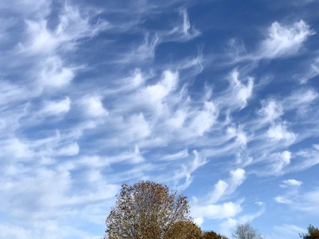
These clouds, found in regions with moderate and tropical climates, typically form at altitudes of about 5-13 kilometers. Cirrus clouds are characterized by their white and grayish color and often appear as thin, wispy sheets that can spread and thicken.
Now, if you spot these clouds while adventuring, it can indicate that the weather is going to deteriorate within the next 24-36 hours. However, not only that, when they appear unevenly, irregularly, and slowly shift due to increasing pressure and dry weather, they can also signify good weather ahead.
2. Cirrocumulus Clouds
You’ve probably seen these clouds before; Cirrocumulus clouds, located at an altitude of about 5 kilometers, consist of small clouds with fine, wavelike patterns resembling the ripples on water.
Cirrocumulus clouds indicate clear weather. However, if there are a few groups of cirrus clouds within the cirrocumulus clouds, it might suggest that rain is likely within the next 8-10 hours, depending on the movement of the clouds.
3. Altocumulus Clouds

These clouds, situated at an altitude of 2-6 kilometers, typically exhibit round or rolling and wavy characteristics. Altocumulus clouds are generally dark, but they can also appear white or gray.
The darker these clouds, the higher the likelihood of rain in the near future. However, if these clouds appear in the morning, it may indicate the possibility of a storm occurring in the afternoon.
4. Cumulonimbus Clouds
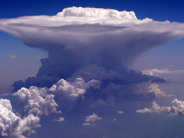
Forming at altitudes between 200 to 4,000 meters, Cumulonimbus clouds are characterized by their wide and flat appearance, often appearing white or dark at their lower regions. Sometimes, they can also have protruding bulges hanging beneath them.
If you spot these clouds while adventuring, it’s advisable to seek shelter and be cautious, as Cumulonimbus clouds can bring heavy rain, strong winds, thunder, lightning, and even develop into a tornado.
5. Stratocumulus Clouds

These clouds typically appear as large, round, and dark formations. Stratocumulus clouds often form in groups, lines, or waves.
These clouds, which form at altitudes below 2.4 kilometers, are categorized as low-level clouds. Despite their dark appearance, they often indicate stable weather conditions, with little to no rain or light rain.
So, Superfriends, those are some ways to predict the weather based on cloud formations while you’re adventuring in the wilderness. Now you can predict the weather without relying on gadgets, right?
Source : https://www.indosurvival.com



Tuliskan Komentar